NOTICE
This website is undergoing major revision.Therefore, it is currently no longer updated, except for minor corrections.
As an intermediate step, an overview document about national height transformation surfaces (a.k.a. geoid models) has been compiled. It is available via the EVRS website under:https://doi.org/10.71603/NatRefEurope.
The information is based on the contributions that the bodies responsible for the national geodetic reference (e.g. national mapping agencies) have submitted since 2022. Besides information about the national height systems and geoid models, it also contains specifics of the current national ETRS89 realizations and their relations to the European realizations (ETRF). This information is relevant for centimeter accuracy and frequently not included in inventories of coordinate reference systems such as the EPSG.
For details, please refer to the corresponding EVRS website https://evrs.bkg.bund.de/Subsites/EVRS/EN/Results_and_Products/NationalRealizationsETRS89/national_realization.html.
Description of national Coordinate Reference Systems (CRS) of European Countries
Contains
- descriptions of Coordinate Reference Systems
- transformation parameters to pan-European CRS ETRS89, EVRF2000, EVRF2007 and EVRF2019
- verification data for transformation
- online-transformation of single points for position and height from national CRS of a country to pan-European CRS ETRS89, EVRF2000 and EVRF2007 for test and verification purposes
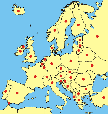
To get the information select a country in the list or click on the corresponding red dot in the map
 The border of Kosovo is used without prejudice to positions on status and is in line with UNSC 1244 and the ICJ Opinion on the Kosovo declaration of independence.